


![[The AI Show Episode 146]: Rise of “AI-First” Companies, AI Job Disruption, GPT-4o Update Gets Rolled Back, How Big Consulting Firms Use AI, and Meta AI App](https://www.marketingaiinstitute.com/hubfs/ep%20146%20cover.png)


![Ditching a Microsoft Job to Enter Startup Purgatory with Lonewolf Engineer Sam Crombie [Podcast #171]](https://cdn.hashnode.com/res/hashnode/image/upload/v1746753508177/0cd57f66-fdb0-4972-b285-1443a7db39fc.png?#)


.jpg?width=1920&height=1920&fit=bounds&quality=70&format=jpg&auto=webp#)


-xl.jpg)


![Beats Studio Buds + On Sale for $99.95 [Lowest Price Ever]](https://www.iclarified.com/images/news/96983/96983/96983-640.jpg)

![New iPad 11 (A16) On Sale for Just $277.78! [Lowest Price Ever]](https://www.iclarified.com/images/news/97273/97273/97273-640.jpg)


![Apple's 11th Gen iPad Drops to New Low Price of $277.78 on Amazon [Updated]](https://images.macrumors.com/t/yQCVe42SNCzUyF04yj1XYLHG5FM=/2500x/article-new/2025/03/11th-gen-ipad-orange.jpeg)


![[Exclusive] Infinix GT DynaVue: a Prototype that could change everything!](https://www.gizchina.com/wp-content/uploads/images/2025/05/Screen-Shot-2025-05-10-at-16.07.40-PM-copy.png)


![T-Mobile discontinues a free number feature but a paid alternative exists [UPDATED]](https://m-cdn.phonearena.com/images/article/170235-two/T-Mobile-discontinues-a-free-number-feature-but-a-paid-alternative-exists-UPDATED.jpg?#)


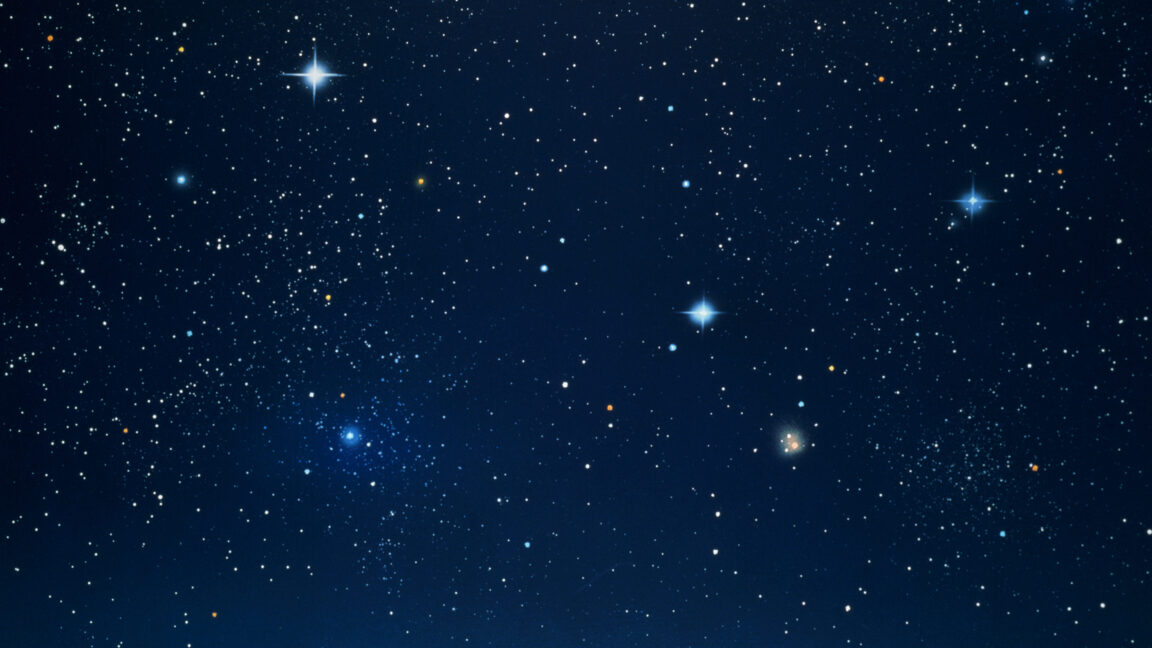
A Stargazer’s Guide to New Light Pollution Map[2025]
Hey, fellow stargazers and tech enthusiasts! If you’ve ever tried to spot the Milky Way only to be drowned out by city lights, I’ve got a tool you’ll love: Light Pollution Map. This slick web app is a must-have for anyone passionate about astronomy or astrophotography. Built with a clean interface and powered by solid data, it helps you find the darkest skies for epic stargazing sessions. Let’s dive into what makes it awesome and why it’s a game-changer for coders and skywatchers alike. What’s the Deal with Light Pollution Map? Light Pollution Map 2025 is an interactive web app that maps global light pollution using NOAA’s VIIRS satellite data and the 2015 World Atlas. It’s like Google Maps for stargazers, showing you where to find dark skies based on the Bortle Scale (Class 1 for pristine darkness, Class 9 for city-level light pollution) and Sky Quality Meter (SQM) readings. Whether you’re debugging code by day or chasing stars by night, this tool makes planning your next stargazing trip a breeze. Why It’s a Big Deal Light pollution is the enemy of every stargazer. It washes out stars, making it nearly impossible to see constellations or snap that perfect Milky Way shot. This app cuts through the noise by pinpointing low-light-pollution spots, whether you’re near a city or planning a remote adventure. Plus, it’s free, open to all, and doesn’t bombard you with ads. Cool Features for Stargazers and Coders Here’s the rundown on what Light Pollution Map brings to the table: Bortle Scale: Instantly check a location’s sky darkness (Class 1–9) to know if it’s worth the trip. SQM Data: Get nerdy with precise sky brightness measurements in mag/arcsec². Dark Sky Finder: Plug in an address or use IP-based location to find nearby stargazing spots. Astrophotography Support: Plan Milky Way shots with optimal low-light locations. Mobile-Ready: Fully optimized for mobile, with the StargazingHub app for offline access. What’s neat for devs? The site’s clean UI and responsive design are a masterclass in web dev done right. It’s built to be fast, intuitive, and functional, with plans for future features like aurora forecasting and a community hub for sharing stargazing data. If you’re into building apps with real-world impact, this is worth a peek for inspiration. How to Jump In Head to Light Pollution Map 2025 and start exploring. Zoom around the map, search for a spot, and check its Bortle rating or SQM value. Planning a stargazing trip? Download the StargazingHub app for offline access in the middle of nowhere. It’s straightforward, free, and works like a charm on any device. Why It’s Worth Your Time As a coder and stargazer, I dig tools that are both practical and elegant. Light Pollution Map nails it with its no-fuss design and science-backed data. It’s perfect for quick checks before a night under the stars or deep dives into planning astrophotography projects. The fact that it’s free and actively improving (aurora forecasts, anyone?) makes it a no-brainer. For astronomy newbies, it demystifies light pollution with clear Bortle and SQM explanations. For pros, it’s a reliable way to scout dark-sky locations. And for devs, it’s a reminder of how tech can make niche hobbies like stargazing more accessible. Wrap-Up Light Pollution Map is your ticket to better stargazing. It’s a beautifully crafted tool that blends science, tech, and a love for the cosmos. Whether you’re coding by day or stargazing by night, give it a spin and find your next dark-sky adventure. Who knows—you might just catch the Milky Way in all its glory.
![A Stargazer’s Guide to New Light Pollution Map[2025]](https://media2.dev.to/dynamic/image/width=800%2Cheight=%2Cfit=scale-down%2Cgravity=auto%2Cformat=auto/https%3A%2F%2Fdev-to-uploads.s3.amazonaws.com%2Fuploads%2Farticles%2Fuzdfc4dtc7seqgysfu3x.png)
Hey, fellow stargazers and tech enthusiasts! If you’ve ever tried to spot the Milky Way only to be drowned out by city lights, I’ve got a tool you’ll love: Light Pollution Map. This slick web app is a must-have for anyone passionate about astronomy or astrophotography. Built with a clean interface and powered by solid data, it helps you find the darkest skies for epic stargazing sessions. Let’s dive into what makes it awesome and why it’s a game-changer for coders and skywatchers alike.
What’s the Deal with Light Pollution Map?
Light Pollution Map 2025 is an interactive web app that maps global light pollution using NOAA’s VIIRS satellite data and the 2015 World Atlas. It’s like Google Maps for stargazers, showing you where to find dark skies based on the Bortle Scale (Class 1 for pristine darkness, Class 9 for city-level light pollution) and Sky Quality Meter (SQM) readings. Whether you’re debugging code by day or chasing stars by night, this tool makes planning your next stargazing trip a breeze.
Why It’s a Big Deal
Light pollution is the enemy of every stargazer. It washes out stars, making it nearly impossible to see constellations or snap that perfect Milky Way shot. This app cuts through the noise by pinpointing low-light-pollution spots, whether you’re near a city or planning a remote adventure. Plus, it’s free, open to all, and doesn’t bombard you with ads.
Cool Features for Stargazers and Coders
Here’s the rundown on what Light Pollution Map brings to the table:
- Bortle Scale: Instantly check a location’s sky darkness (Class 1–9) to know if it’s worth the trip.
- SQM Data: Get nerdy with precise sky brightness measurements in mag/arcsec².
- Dark Sky Finder: Plug in an address or use IP-based location to find nearby stargazing spots.
- Astrophotography Support: Plan Milky Way shots with optimal low-light locations.
- Mobile-Ready: Fully optimized for mobile, with the StargazingHub app for offline access.
What’s neat for devs? The site’s clean UI and responsive design are a masterclass in web dev done right. It’s built to be fast, intuitive, and functional, with plans for future features like aurora forecasting and a community hub for sharing stargazing data. If you’re into building apps with real-world impact, this is worth a peek for inspiration.
How to Jump In
Head to Light Pollution Map 2025 and start exploring. Zoom around the map, search for a spot, and check its Bortle rating or SQM value. Planning a stargazing trip? Download the StargazingHub app for offline access in the middle of nowhere. It’s straightforward, free, and works like a charm on any device.
Why It’s Worth Your Time
As a coder and stargazer, I dig tools that are both practical and elegant. Light Pollution Map nails it with its no-fuss design and science-backed data. It’s perfect for quick checks before a night under the stars or deep dives into planning astrophotography projects. The fact that it’s free and actively improving (aurora forecasts, anyone?) makes it a no-brainer.
For astronomy newbies, it demystifies light pollution with clear Bortle and SQM explanations. For pros, it’s a reliable way to scout dark-sky locations. And for devs, it’s a reminder of how tech can make niche hobbies like stargazing more accessible.
Wrap-Up
Light Pollution Map is your ticket to better stargazing. It’s a beautifully crafted tool that blends science, tech, and a love for the cosmos. Whether you’re coding by day or stargazing by night, give it a spin and find your next dark-sky adventure. Who knows—you might just catch the Milky Way in all its glory.